A rare find provides a glimpse of Holmes County never seen before
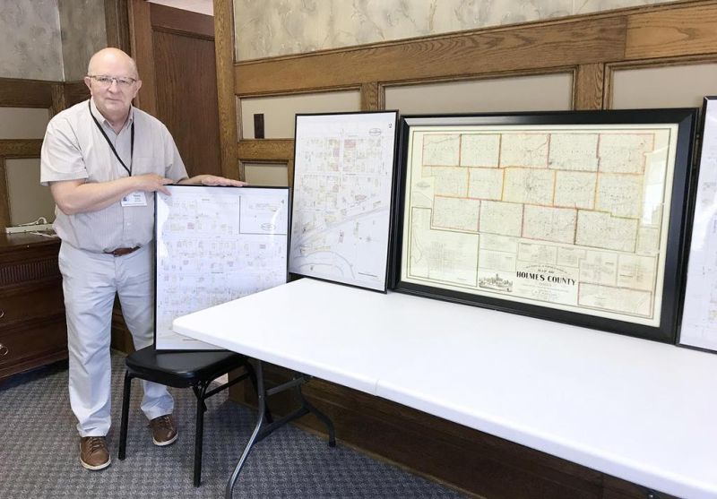
The Holmes County Historical Society is blessed with a number of old maps of the county, but a recent find in Columbus has led executive director Mark Boley to feel like he hit an absolute goldmine of Holmes County lore.
While attending a historical meeting in Columbus this past fall, Boley came across a gentleman who had all kinds of old maps, which he was both exhibiting and selling.
Boley said he was attending a state historical conference, and several people were set up at a trade show in the hallway. One gentleman had a large-screen television and was showing some old maps.
It caught Boley’s attention, and they struck up a conversation.
“He eventually asked me where I was from, and when I told him Millersburg, Ohio, he said, ‘I’ll bet there are some from Millersburg.’ I said there was probably no way that was the case,” Boley said. “He started working on his computer, and then ‘boom,’ there was downtown Millersburg right there in front of me. I asked him where he found them.”
The answer was exciting for Boley, who said the man told him these old maps were just released to the general public last year by the Library of Congress.
The recently released maps are known as the Sanborn Maps. Boley said before 1900 the Sanborn Company made detailed maps of communities all across the United States for the fire-insurance industry.
“These maps were so detailed because the fire companies used the maps to produce a rating for fire-insurance purposes,” Boley said. “The maps showed the insurance companies where the doors and windows were, how many floors there were, the color of the building that denoted what it was made of and in some cases the actual name of the business.”
That even led to some discoveries such as the Brightman Manufacturing Company, a business the society members had no idea where it actually existed in Millersburg.
“It’s on one of the maps,” Boley said. “There is a detailed floor plan. I was so excited I could hardly stand it.”
Boley is now in possession of the old maps and has the blow-ups for those who really want to dig into the lay-out of the various areas. Boley even took the maps to the Holmes County Map Office, and they had never seen anything like them before. They were generous enough to print the larger maps, so Boley agreed to have them put the maps on their computer.
“These were really old maps that nobody even knew existed,” Boley said. “After I got access to the maps, I made some large blow-ups and will eventually have a PowerPoint program to discuss them. It should be an incredible look into the history of Historic Downtown Millersburg that we have not been able to explore before.”
Boley, a self-described map junkie, said he knew immediately he had to create a presentation evening and shared his vision with the Holmes County Historical Society program committee, which quickly agreed this would be a fascinating presentation.
The event was originally slated to take place Thursday, Aug. 20 but was postponed due to COVID-19 concerns. With an event date now set for some time in 2021, Boley will have to patiently wait to share these gems with the public.
“We debated a long time on whether to go ahead with the original date or not, but in the end we felt it was safer to postpone it until next year,” Boley said. “Plus, we would much rather do it during a time when everyone can come and feel comfortable about being there to enjoy such a wonderful evening.”
The maps that make up the eventual presentation include a county map from 1861, a map that Boley said is perhaps the oldest known map of Holmes County. Additional maps showcase some of the old one-room schoolhouses throughout the county, with more than 200 schools dotting the map.
While people will have to wait to experience this event, Boley said it will be great for not just history buffs, but also for the many downtown Millersburg business owners who are interested in learning more about their building.
“When it actually gets here, it should be a really neat program unlike any we’ve had before,” Boley said. “People are going to be amazed at these maps that were found. The maps were done in the late 1890s and show the opera house, where the stage was, what all the buildings downtown were made of, the steam lines between the courthouse and the boiler house. It’s all there, and it is really cool.”
The architecture in and around Millersburg has always been both beautiful and intriguing to many, but delving back into HDM about 130 years ago to explore the fine details of how the village was built should be just as fascinating to explore.

